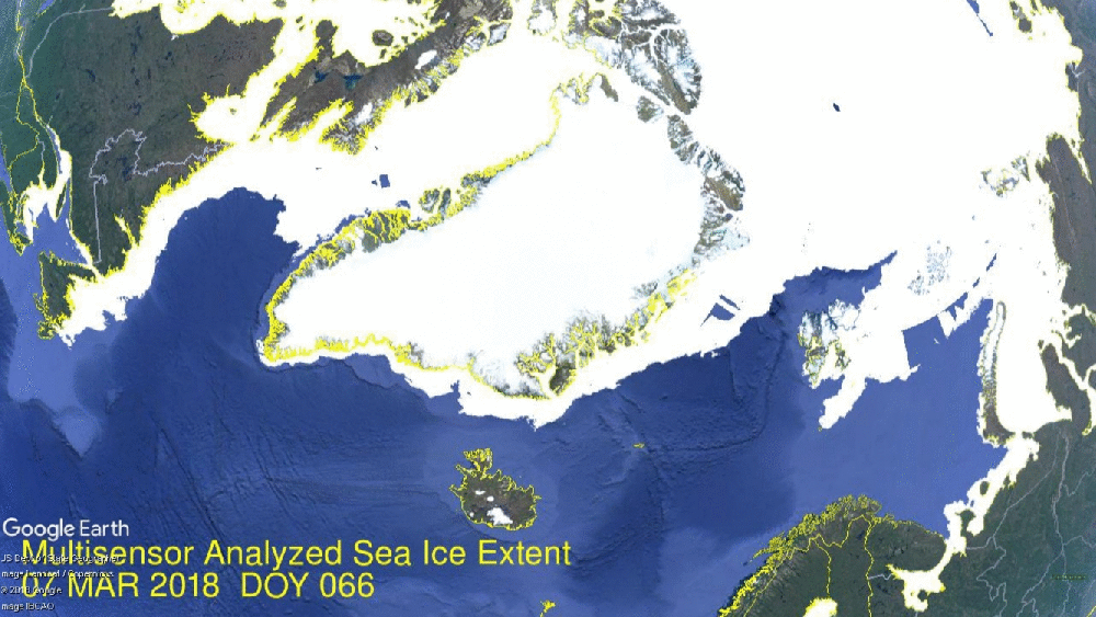
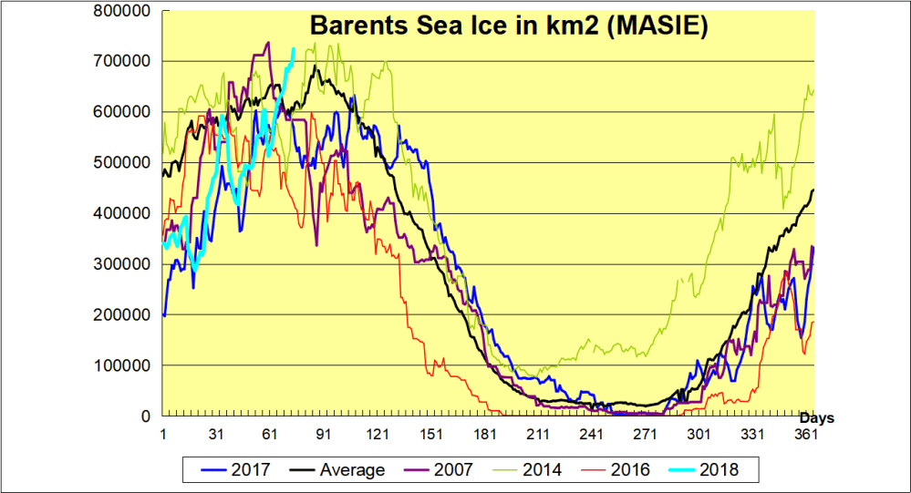
After stalling first week of March, Arctic ice is coming on strong now. The image above shows the last week, setting new maximums for 2018 for NH overall, as well in Barents Sea. The graph below shows that as of yesterday, Barents is well above the 11 year average, and even ahead of 2014 the highest year in the decade.
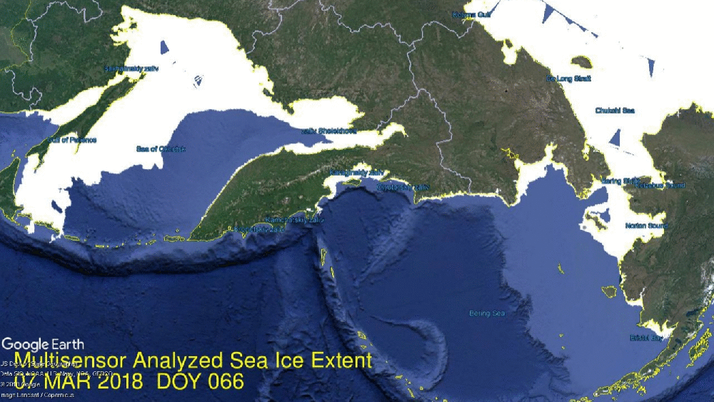
Meanwhile ice extent is increasing on the Pacific side as well. Bering rapidly grew 200k km2 in a week, setting a new 2018 maximum, while Okhotsk added 110k km2 for a new max ice extent there.
The graph below shows how strongly the Arctic is now freezing over.
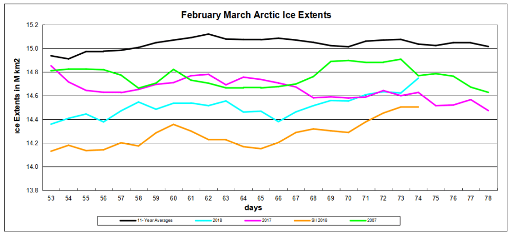
Note the average max on day 62 and 2018 max yesterday on day 74, now matching 2007 and 120k km2 above last year. SII (NOAA) continues to show ~200k km2 less extent.

Drift ice in Okhotsk Sea at sunrise.
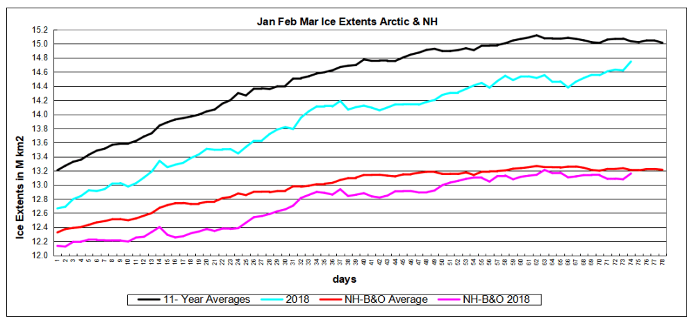
The graph below shows 2018 NH ice extents since day 1, with and without the Pacific basins Bering and Okhotsk, compared to 11 year averages (2007 to 2017 inclusive).
The deficit is almost entirely due to Bering, with the shortfall closing in the last week.

