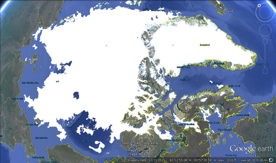
Imagery date refers to Google Earth capture of land forms. Ice edges are dated August 15, 2016 from MASIE. Click on image to zoom in.
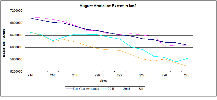
In the chart below MASIE shows 2016 August Arctic ice extent drew near to average and close to 2015, then dropped lower before leveling off a bit yesterday. Presently mid-August is about 400k less than average and 2015. With SII back on line, it was reporting similar extents during June (as it has in the past). This month it is starting to underestimate again, ~200k km2 lower. (SII and MASIE comparison is here.)
Looking into the details, some marginal seas are melting earlier than last year, while the central, enduring ice pack is relatively typical for this time of year.
At the present pace of declining ice extents, 2016 is running 3 days ahead of 2015 and 6 days in advance of the ten-year average.
Comparing the Arctic ice extents with their maximums shows the melting is occurring mostly in the marginal seas: Down the most are Beaufort, E. Siberian and Kara seas, with Laptev higher. Chukchi and Central Arctic are also slightly higher.
| Region | 2016228 | Day 228 Average | 2016-Ave. |
| (0) Northern_Hemisphere | 5638938 | 6077428 | -438491 |
| (1) Beaufort_Sea | 460422 | 732896 | -272475 |
| (2) Chukchi_Sea | 460556 | 451013 | 9543 |
| (3) East_Siberian_Sea | 425918 | 614576 | -188658 |
| (4) Laptev_Sea | 436021 | 258060 | 177960 |
| (5) Kara_Sea | 34418 | 113901 | -79483 |
| (6) Barents_Sea | 0 | 28263 | -28263 |
| (7) Greenland_Sea | 210175 | 250577 | -40402 |
| (8) Baffin_Bay_Gulf_of_St._Lawrence | 43329 | 50525 | -7196 |
| (9) Canadian_Archipelago | 394745 | 402828 | -8083 |
| (10) Hudson_Bay | 50896 | 72085 | -21188 |
| (11) Central_Arctic | 3121317 | 3101598 | 19719 |
| (12) Bering_Sea | 0 | 23 | -23 |
| (13) Baltic_Sea | 0 | 2 | -2 |
| (14) Sea_of_Okhotsk | 0 | 29 | -29 |
Presently Arctic Ice extent is down from its March maximum by 62.6%. The bulk of ice losses are coming from Okhotsk, Barents and Bering Seas (100% melted), along with Kara Sea, Hudson Bay and Baffin Bay-St. Lawrence (96+% melted). All of them are marginal seas that will go down close to zero by September.
For more context on Arctic ice extent see Arctic Ice Watch July 31. For those who wish to browse Arctic ice in Google Earth, the procedure is simple. Go to MASIE homepage and download the kmz file. Clicking on the file should open it in Google Earth (presuming it is on your computer.) Then you can browse, zoom in and out, and take images.

