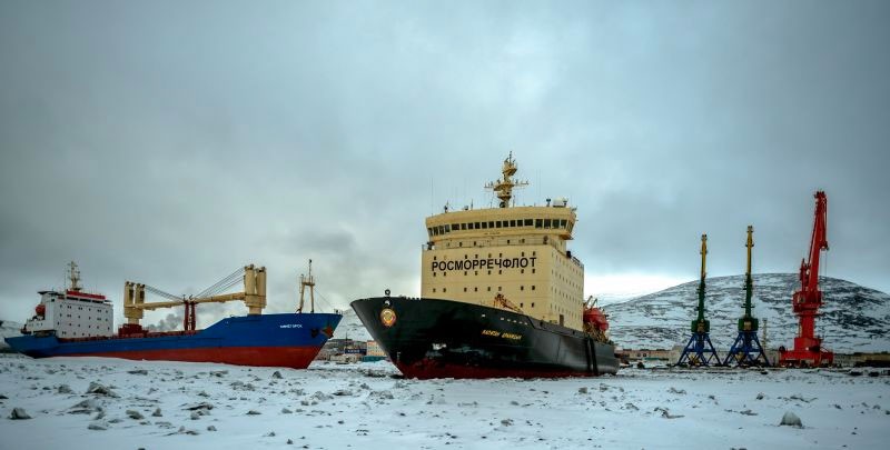
Icebreaker “Kapitan Dranitsyn” has been trapped in Pevek along with two cargo vessels since early January. Photo: Rosmorport May30, 2017
In July, the Northern Sea Route (NSR) starts to open for commercial shipping. As previously reported here Arctic Ice Takes Revenge, a convoy of Russian cargo ships including icebreakers were trapped by January ice and were stranded in Pevek. May 30 they were able to leave port, but making it home to Arkhangelsk is still uncertain since plenty of ice remains in Eastern Siberian and Laptev seas.

More about the NSR shipping situation at the end of this post.
The image below shows the evolution of ice extents since 2007 along the Northern Sea Route. The principal challenge for shipping is Laptev sea, and secondarily East Siberian and Kara seas.
The graph below shows Arctic ice extents comparing 2017 to the eleven-year average, to 2016 and 2007, as well as SII estimates.
This year ice extents are ~200k km2 higher than average at day 208, 660k km2 greater than 2016, and 760k km2 surplus above 2007. MASIE, with its higher resolution mapping shows 600k km2 more ice than Sea Ice Index (SII).
The table below presents the ice extents in various regions of the Arctic Ocean.
| Region | 2017208 | Day 208 Average |
2017-Ave. | 2007208 | 2017-2007 |
| (0) Northern_Hemisphere | 7616280 | 7412179 | 204101 | 6854322 | 761958 |
| (1) Beaufort_Sea | 817086 | 800703 | 16383 | 731315 | 85771 |
| (2) Chukchi_Sea | 501448 | 576407 | -74959 | 410291 | 91157 |
| (3) East_Siberian_Sea | 655273 | 859194 | -203922 | 611838 | 43435 |
| (4) Laptev_Sea | 595803 | 493098 | 102705 | 346484 | 249320 |
| (5) Kara_Sea | 234885 | 216677 | 18208 | 263819 | -28935 |
| (6) Barents_Sea | 74162 | 33989 | 40173 | 38450 | 35713 |
| (7) Greenland_Sea | 429112 | 337523 | 91590 | 350141 | 78971 |
| (8) Baffin_Bay_Gulf_of_St._Lawrence | 351594 | 169554 | 182040 | 226232 | 125362 |
| (9) Canadian_Archipelago | 584766 | 603827 | -19062 | 585307 | -542 |
| (10) Hudson_Bay | 153623 | 172129 | -18506 | 114225 | 39398 |
| (11) Central_Arctic | 3217386 | 3146830 | 70556 | 3174877 | 42508 |
The only sizeable 2017 deficits to decadal average are in Chukchi and East Siberian seas. Ice surpluses this year offset the losses, especially in Laptev, Greenland Sea, Baffin Bay and the Central Arctic. Barents has been holding steady at the highest minimum of the decade, set by 2014. 2007 is eclipsed by 2017 in almost every region.
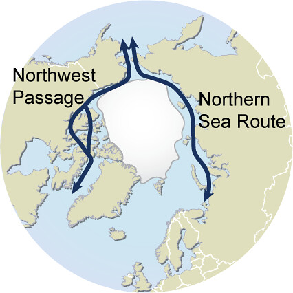
Varying Views of the Northern Sea Route

Text in image refers to events in 2013
Northern Sea Route Information Office
According to the data provided by the Northern Sea Route Information Office, traffic volume in 2016 has increased by 35% in comparison with 2015. However the traffic remained low with only 19 vessels using the route, far from the record set in 2013 with 71 vessels. Steep downturn started in 2014, the amount of cargo transported in transit dropping 77 per cent compared to the previous year.
The navigation season for transit passages on NSR starts approximately at the beginning of July and lasts through to the second half of November. There are no specific dates for commencement and completion of navigation; it all depends on particular ice conditions. In 2011 the navigation season on the NSR seaways for large vessels constituted 141 days in total, i.e. more than 4.5 months. In recent years quite easy ice conditions have been observed and that offers more considerable opportunities for operation at the NSR seaways. All NSR seaways are currently located in the area of one-year ice. In the arctic conditions one-year ice grows approximately up to 1.6 metres. Arktika-type icebreaker can open passages through up to 2.3m thick ice. In early July, at the beginning of navigation ice is not pressurized. The ice is broken and easily moved through. . . Therefore, in the current ice conditions vessels can navigate from July until December.
Malte Humpert, the strategic director and founder of the Arctic Institute
The NSR will not become a major shipping route. Not today and not in 2030 – or even 2050. As long as there is winter ice, which makes the Arctic Ocean unnavigable for part of the year, it will not be suitable for regular transit traffic.
There may be occasional voyages, as we have seen over the past few years, delivering timber from Finland to Canada, or Norwegian fish and LNG to Japan or iron ore to China. But the NSR will not see containerized cargo on which global trade operates. There are a host of reasons for that, the biggest ones being lack of schedule reliability and seasonability of the route, lack of ports of call and increased insurance premiums on the NSR over Suez.
As a comparison: the Suez Canal sees around 18,000 transits per year, the Panama Canal around 15,000, the Straits of Malacca around 65,000.
In the past five years taken together, the NSR saw around 200 transits, with most vessels being tiny compared to the giant container ships and bulk carriers passing through the world’s shipping hubs.

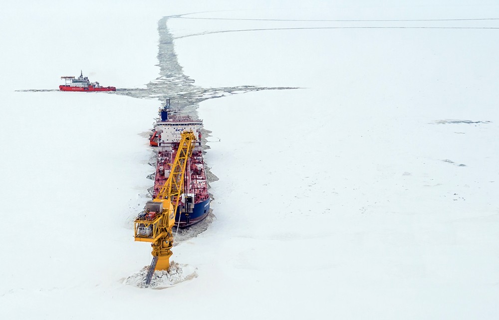
The 259 meters long, 34 meter wide «Shturman Albanov» in early May arrived in Murmansk with another load of oil from Novy Port, the new oil field in the Yamal Peninsula. It marked the 5th million ton of oil delivered from the field, operator Gazprom Neft informs.
In the course of the last 12 months, a total of 196 shiploads of oil have made from Yamal to Murmansk. Shipping company Sovcomflot now has three brand new Arc7 ice class tankers dedicated to shipments from the new Arctic field.


Reblogged this on WeatherAction News and commented:
This is proving a very interesting season to follow
LikeLike
Reblogged this on Climate Collections.
LikeLike