Serenity Nearing Ulukhaktok Aug. 25

Ulukhaktok
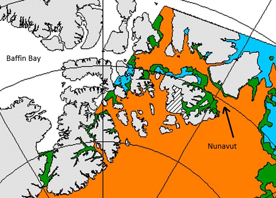
Cruise liner Serenity is nearing its first port of call in the Northwest Passage just outside Nunavut.
Ulukhaktok NWT (population ~450) means “Place one finds material to make ulus.”

Ulu cutting tool made of steel with whale bone handle.
The place name comes from a time when these tools were made of sharpened slate, apparently plentiful in the area.
The ULU (OO-loo) is an extremely versatile cutting tool crafted by the Native Alaskan people over five thousand years ago. The knife was primarily used by Inuit women for skinning and cleaning fish and has played an important role in the survival of the Arctic people. Blades were originally made of polished slate and given a bone, ivory or wood handle. The handles were often inscribed with distinctive designs or markings exclusive to the maker of the knife.
Today, Inuit and people from all walks of life continue to use the versatile ULU as their primary cutting tool, despite the wide availability of other knife designs. Because the center of force is concentrated directly over the middle of the blade, it creates twice the direct downward force compared to that of conventional cutlery (where the force is behind the center of the blade).
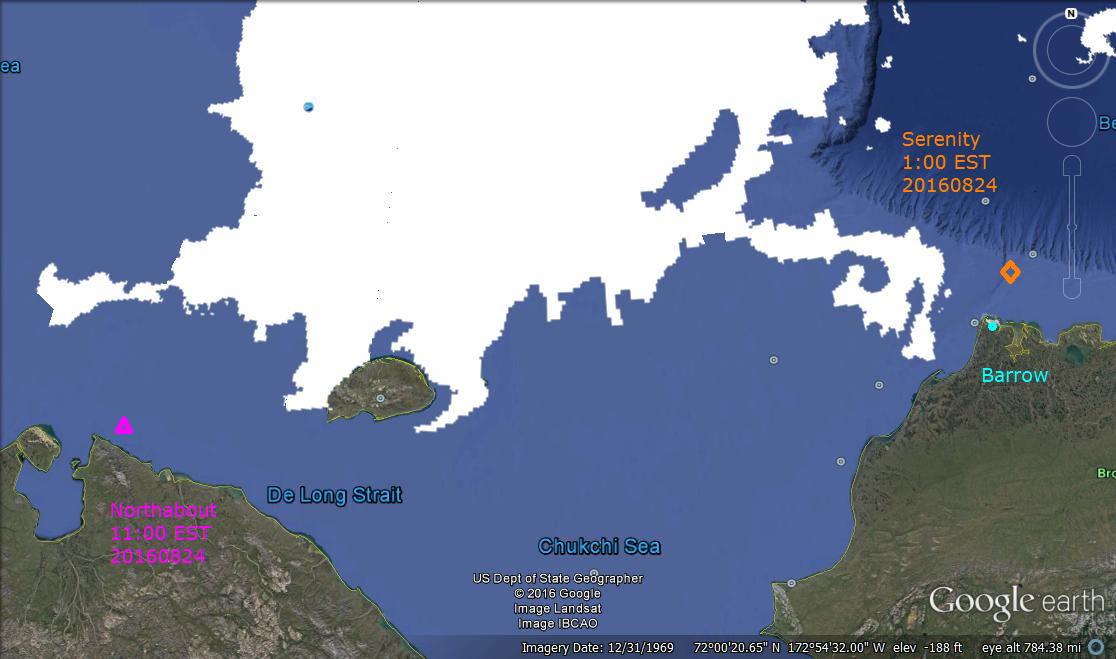
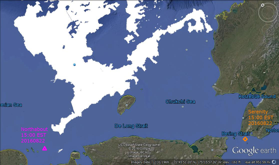
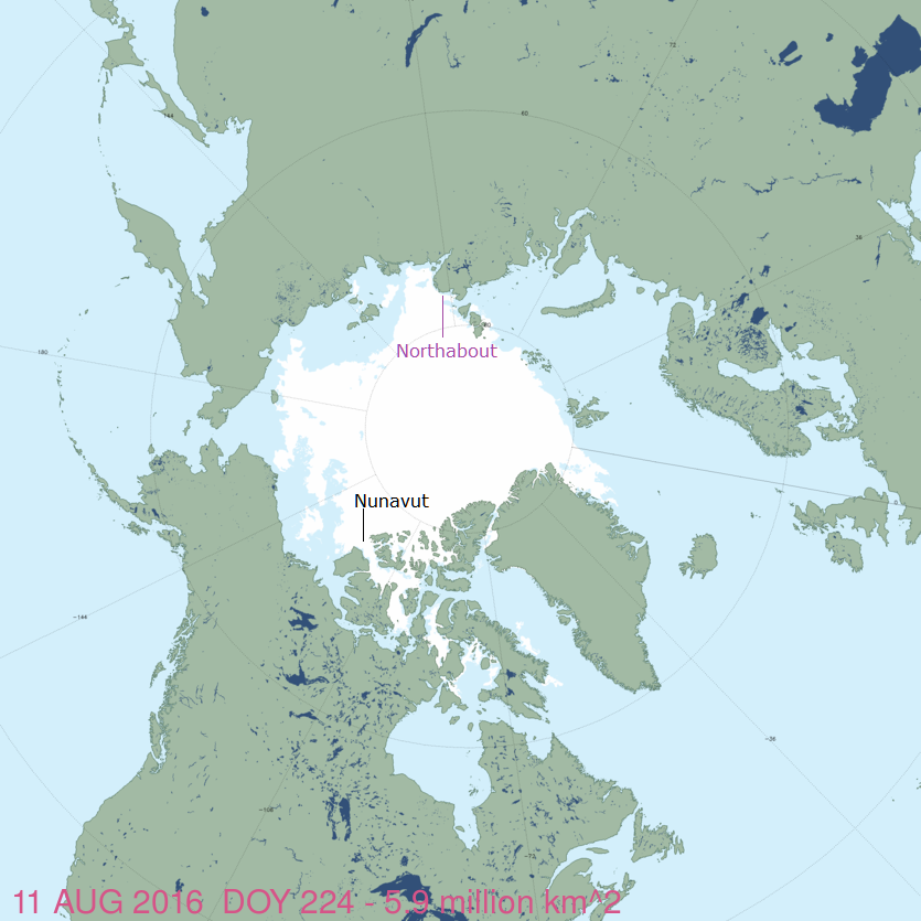
Today’s MASIE ice chart shows ice extent hovering around 5M km2 following the recent cyclone with variability mostly in BCE region (Beaufort, Chukchi, E. Siberian seas). This happens to be the location of two ships exploring the ice extent: Northabout (Polar Ocean Challenge) and Serenity (Celebrity Cruiseliner).
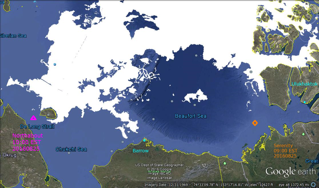
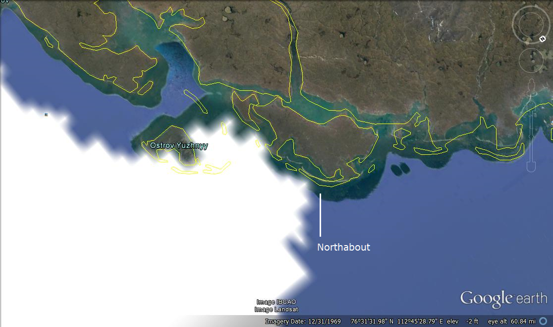
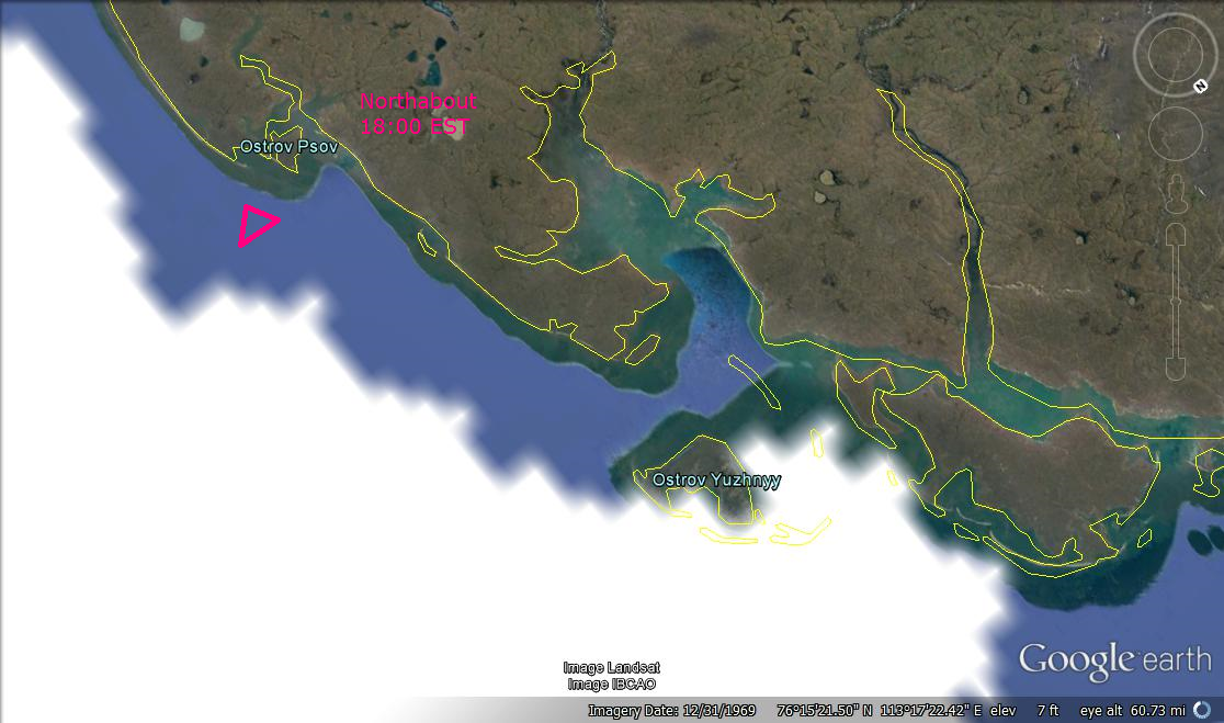
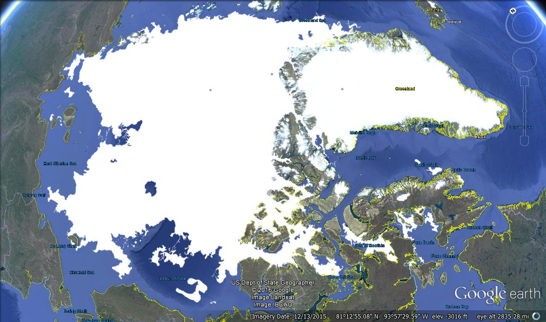
Imagery date refers to Google Earth capture of land forms. Ice edges are August 24, 2016 from MASIE. Click to zoom in.
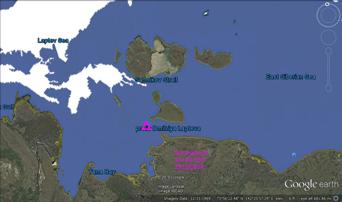
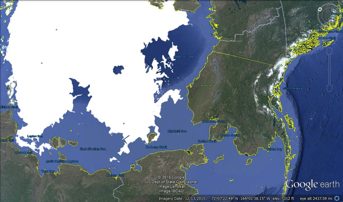
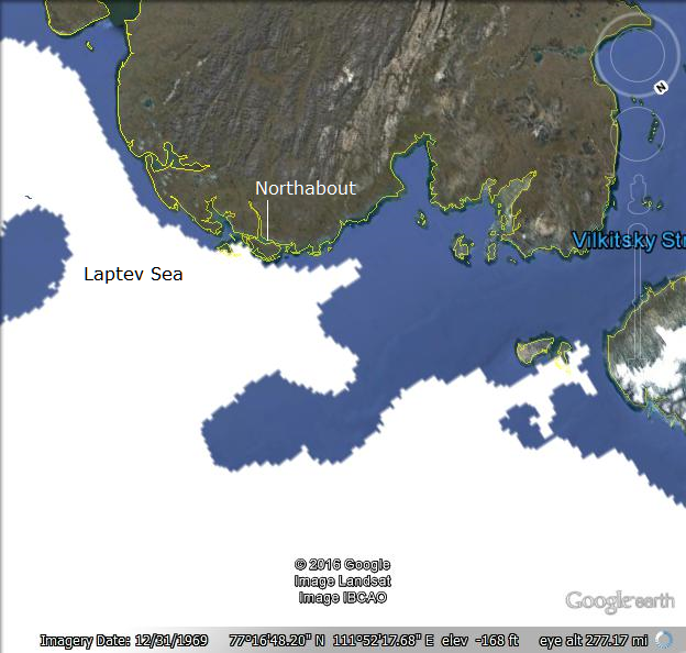
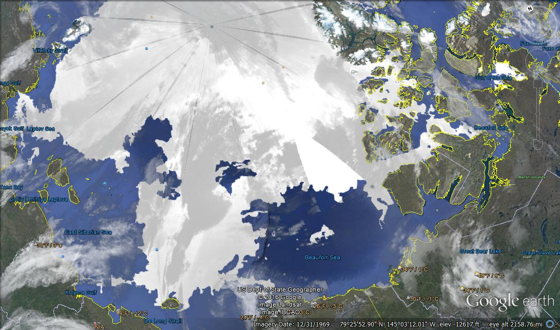
As the image shows, Northabout has passed the ice tongue but has to go further south before proceeding longitudinally. Serenity negotiated an icy area, before passing Barrow and soon approaching Ulukhaktok. The bigger picture below shows that the southern route through the Archipelago is open at this time, but that can change in the days to come.
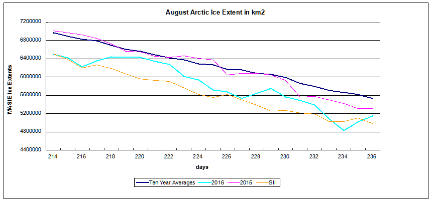
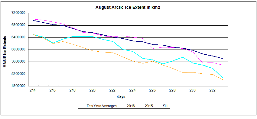
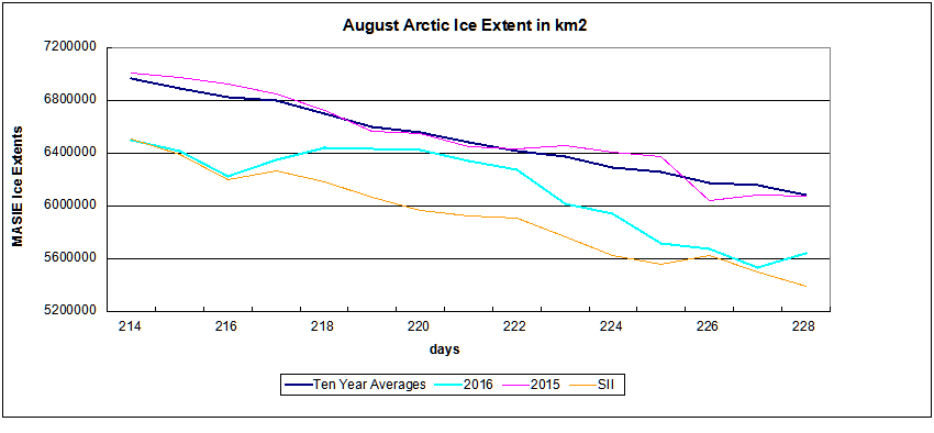
The Arctic Cyclone operating near the north pole has compressed the ice extents, The graph below shows the results: Overall ice extent which had recently stabilized lost 924k km2 in just 5 days. 472k km2 was lost in BCE (Beaufort, Chukchi and East Siberian seas) and another 139k km2 in CAA (Canadian Arctic Archipelago).
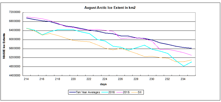
In the last 2 days MASIE shows an overall recovery of 323k km2, with 216k m2 in the BCE region. The graph below shows the indices converging.
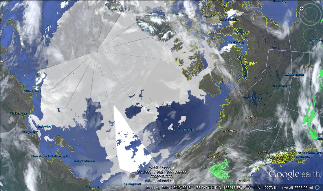
For more context on Arctic ice extent see Arctic Ice Watch July 31. For background on Polar Ocean Challenge see Laptev Wall and Nunavut Gauntlet. For those who wish to browse Arctic ice in Google Earth, the procedure is simple. Go to MASIE homepage and download the kmz file. Clicking on the file should open it in Google Earth (presuming it is on your computer.) Then you can browse, zoom in and out, and take images.

Celebrity Serenity
I was once told by a fellow cruise passenger not to call our ship a boat. He said in the Navy they knew if you were in a boat it meant something awful had happened to your ship.

The Good Ship Northabout